Metamor Keep Maps & Resources
This is the home for all the maps for Metamor Keep, from the Lightbringer temple to the entire world...
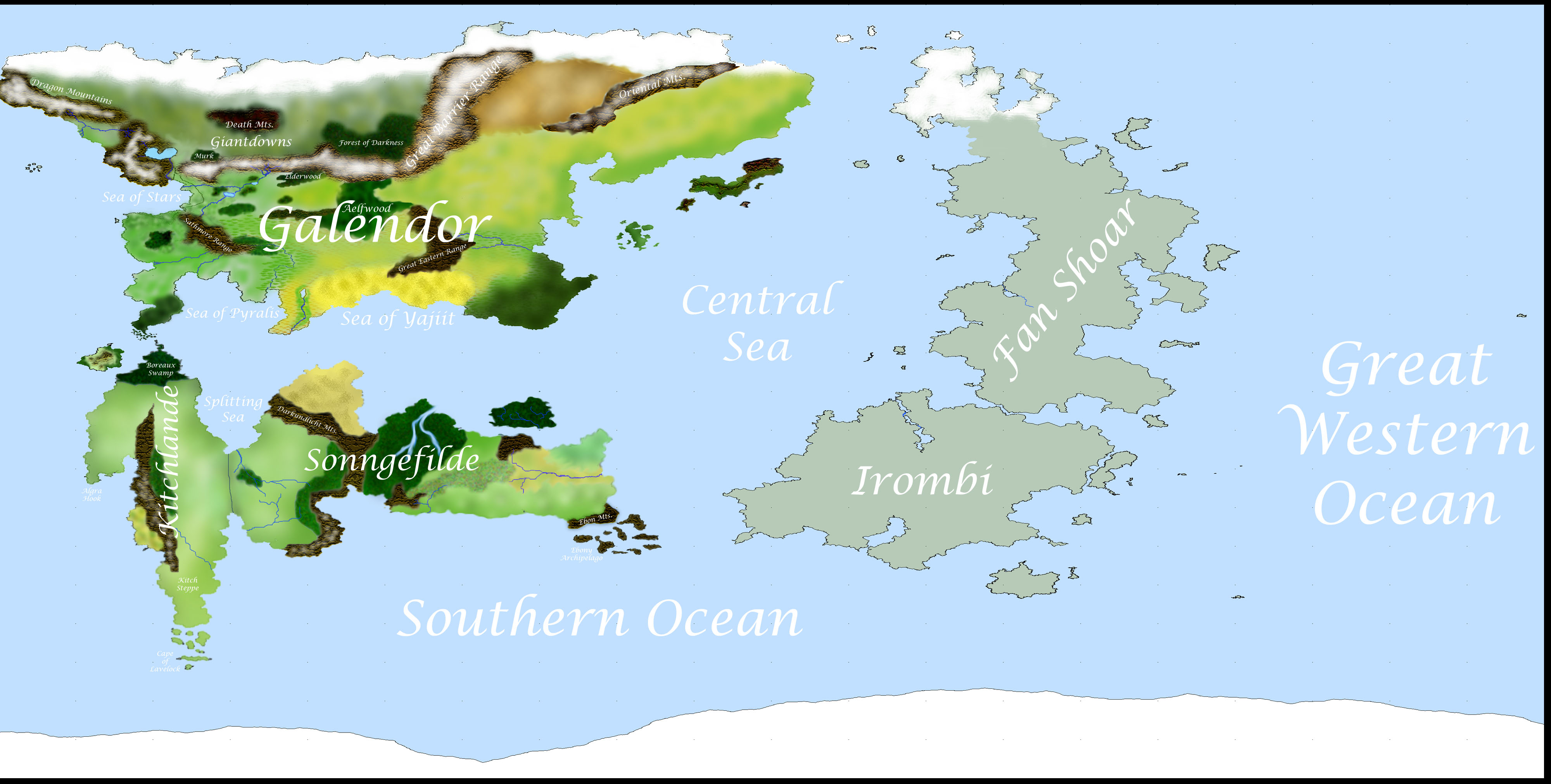
mkworld_terrain.jpg: This is the world map for Metamor Keep, showing all continents in a classical cylindrical projection. Longitude lines have been straightened to run at right angles to latitude lines, so east-west distances appear greater near the poles than they actually are. This version of the map shows only terrain features and geographical names; it does not include political information. The eastern continents are a uniform gray-green because nothing has been established yet about their topography.
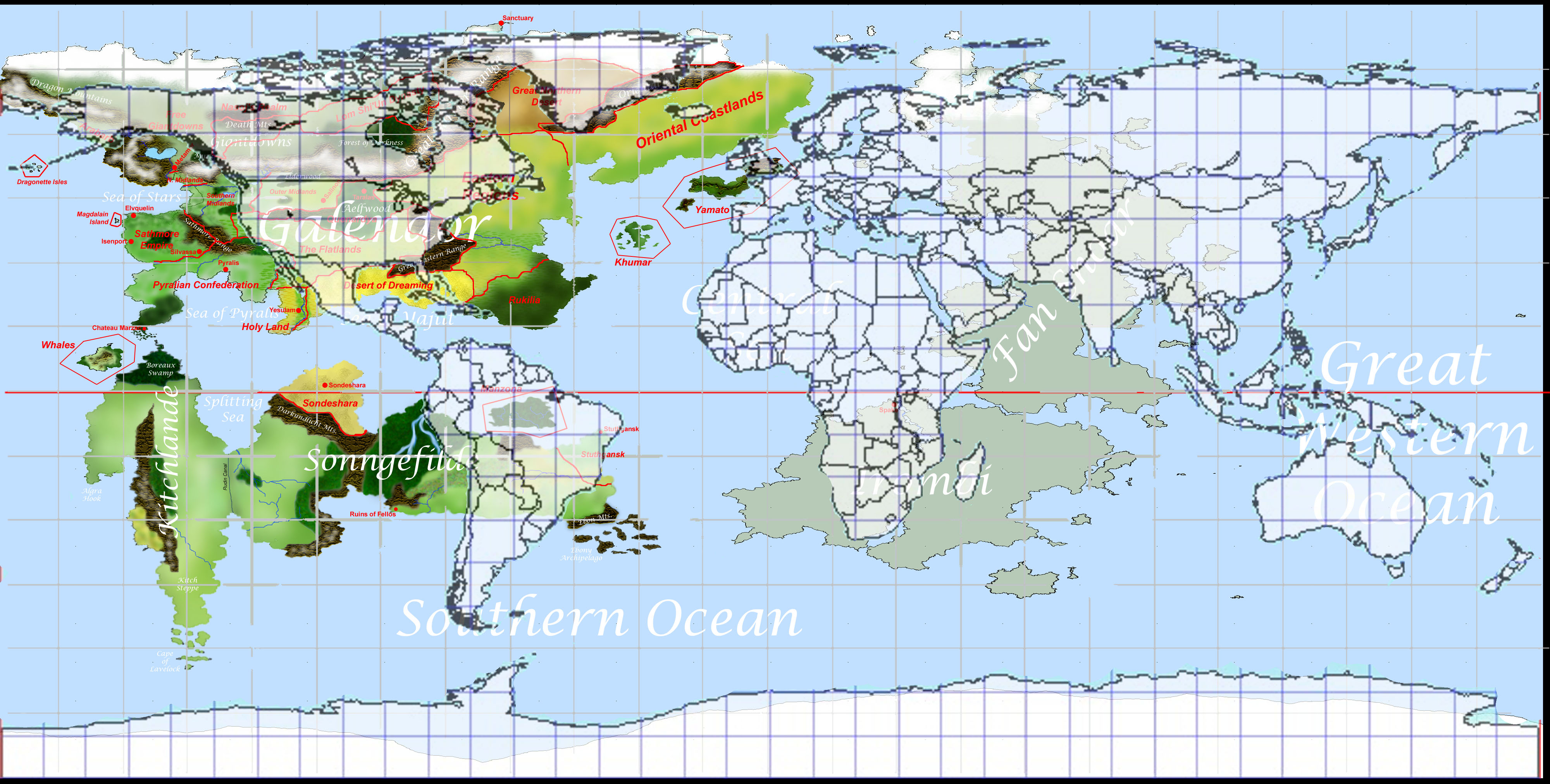
mkworld_political.jpg: Same as the above map, but this version includes some political information. It is not as detailed as the continent-scale map below; refer to that map if you're looking for a higher-resolution view of Galendor.
MK-RL_compare.jpg: An overlay of the continents of RL-Earth atop those of the MK-Earth. Both maps use the same type of map projection, so regions at the same latitude (or the opposite latitude on the other side of the equator) can be compared without worrying about area distortion.
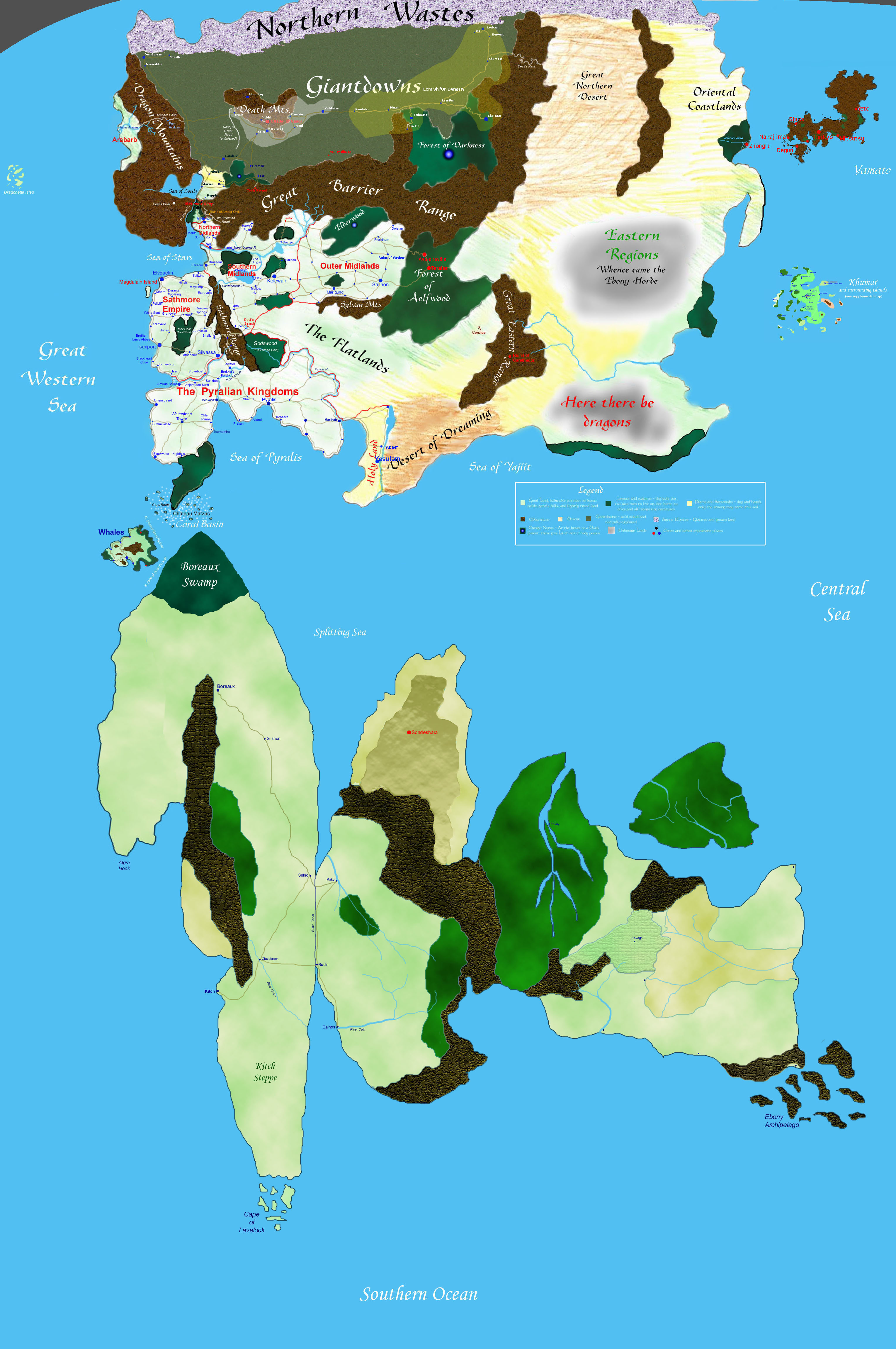
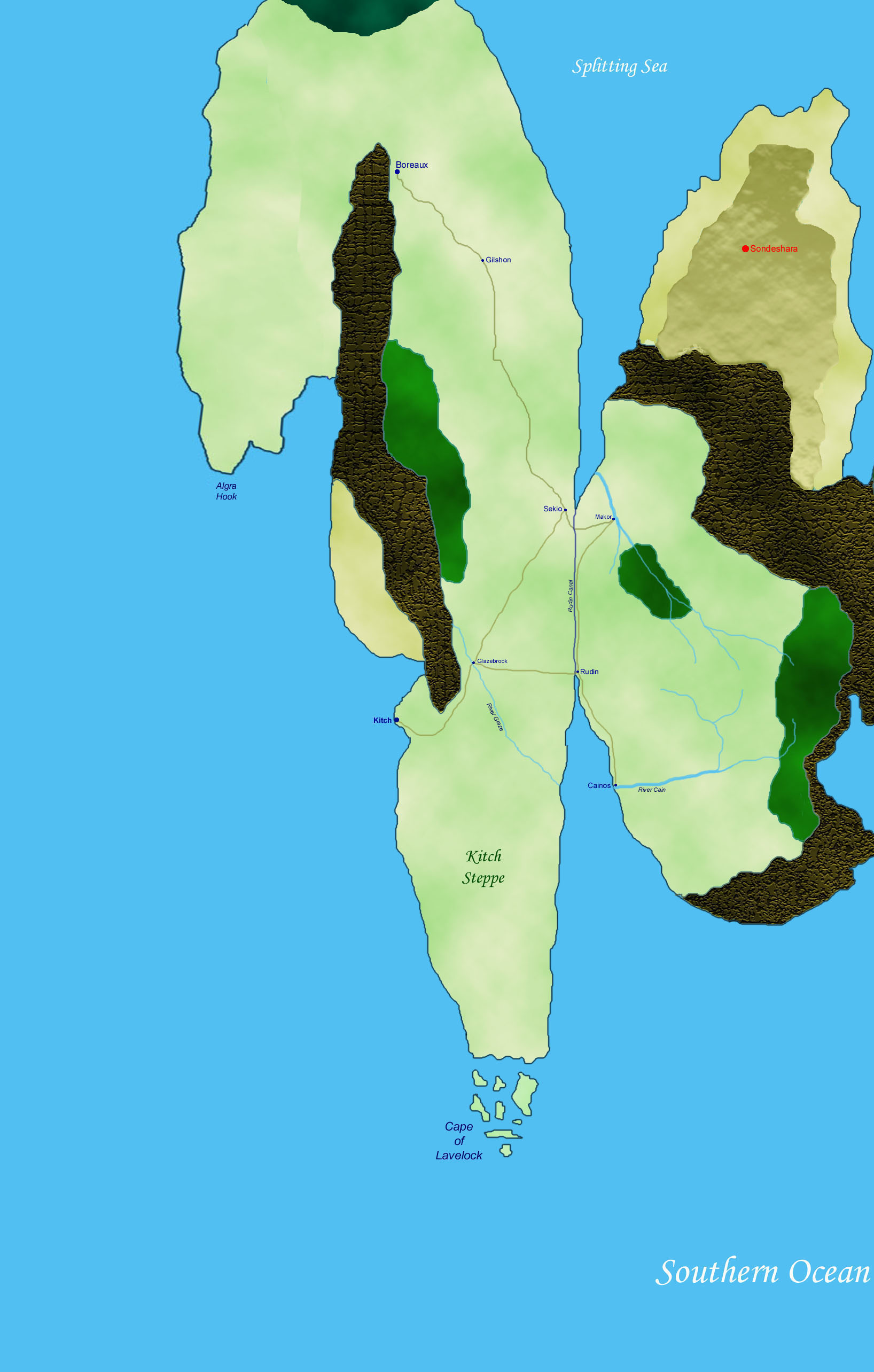
UPDATED mkmap_v7.jpg: This is the continent-scale map of Galendor and the Southlands. It is approximately an equal-area map; latitude and longitude lines would not run straight if drawn on this map, but the landmasses are approximately the same size and shape as they are in the "real" MK world. This is more true of Galendor than it is of the Southlands, which have suffered some of the distortion inevitable in trying to extend a map over such a broad area. The file is 1.5 Mb, so be prepared for a long load time if you don't have broadband -- I recommend right-clicking on the link and selecting "Save Target As..." from the quick menu. Alternatively, you can load the four quadrants of the map separately: Update: The map has now been corrected to include the Ebon Mountains in SE Sonngefilde. NW Quad | NE Quad | SE Quad | SW Quad
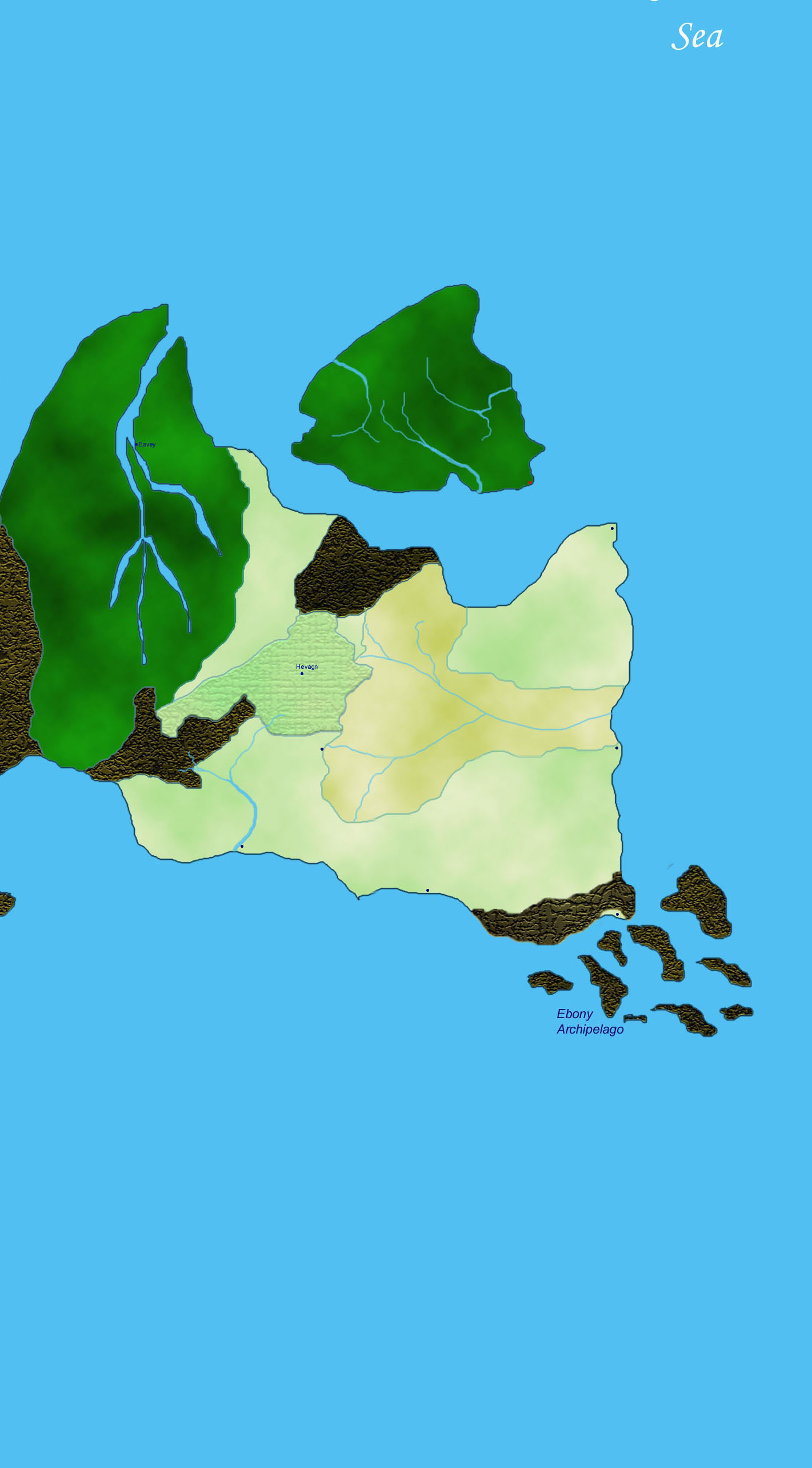
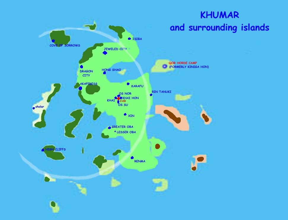
khumar.jpg: A supplemental, higher-resolution map for Khumar and the islands surrounding it. Use this to get a better look at the lands around the eastern kingdom of Os-Var-Khai. (Map provided by Brittany Greatbear and Oren Otter.)
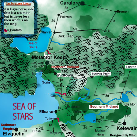
midlandsmap.jpg: This is Winc's map of Metamor Keep and the surrounding lands, with approximate travel times between various cities and other destinations. This gives more detail about the local fiefdoms than the continent map.
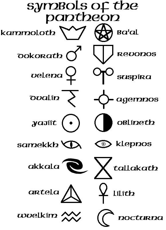
pantheon.jpg: Symbols of the Pantheon of Metamor Keep. These are the holy sigils used by the gods and daedra to represent themselves, their creed and their power on the Earth. Ever wondered what Akkala's "double spiral" really looked like? Now you can see for yourself.
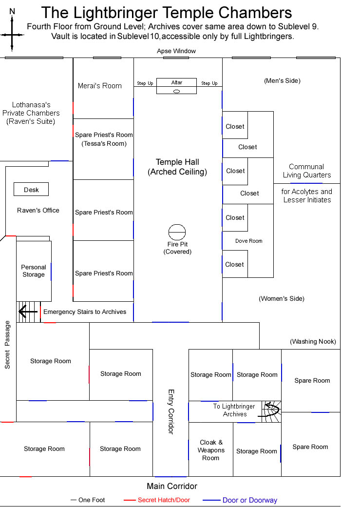
lbmap.jpg: A lot of people have asked me over the years what the layout of the Lightbringer Temple looks like. Well, here it is -- just the main floor, not the Archives or the Vault, but this is where most of the activity takes place. Now you can all stop wondering about it... :)