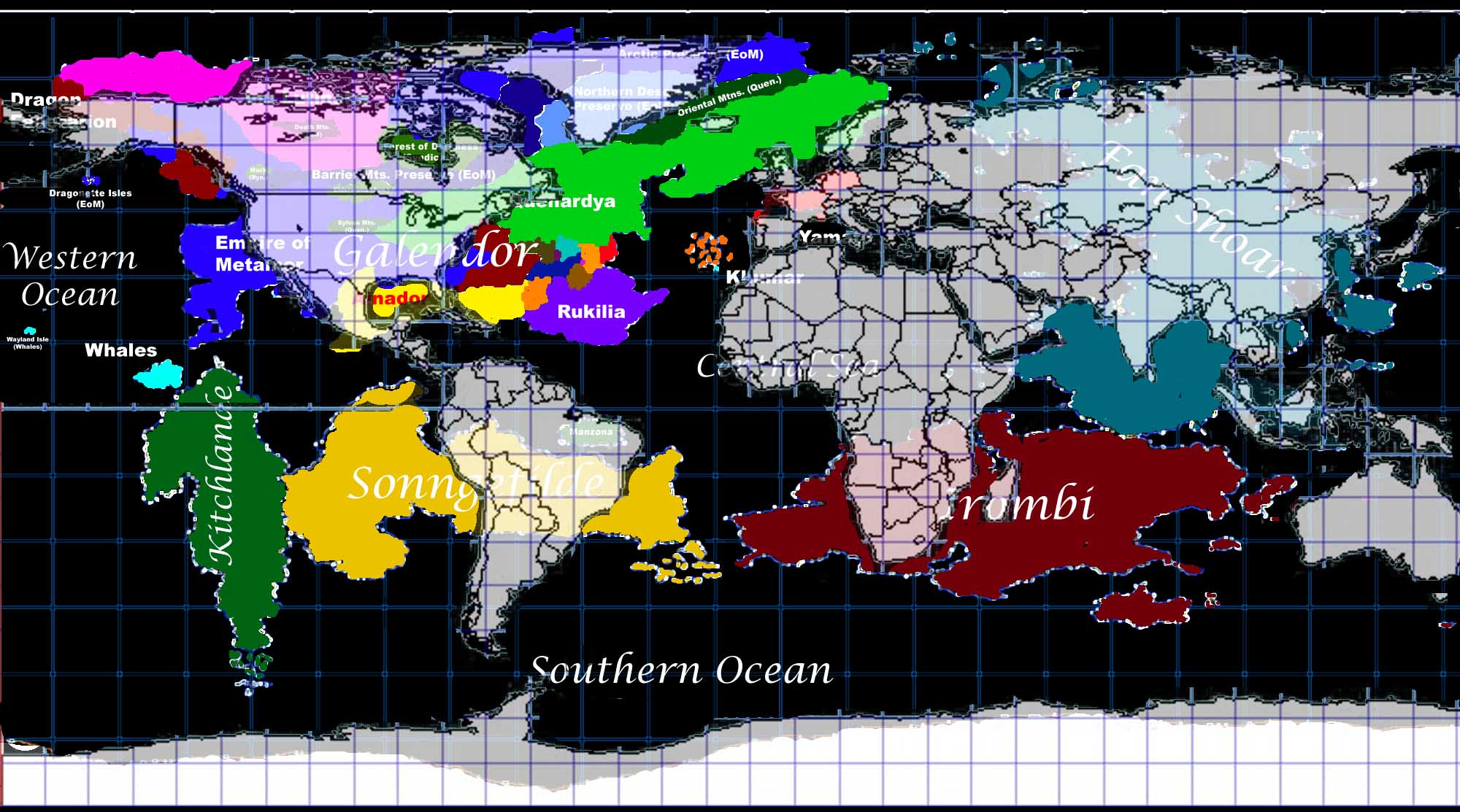
The Earth in MK2K
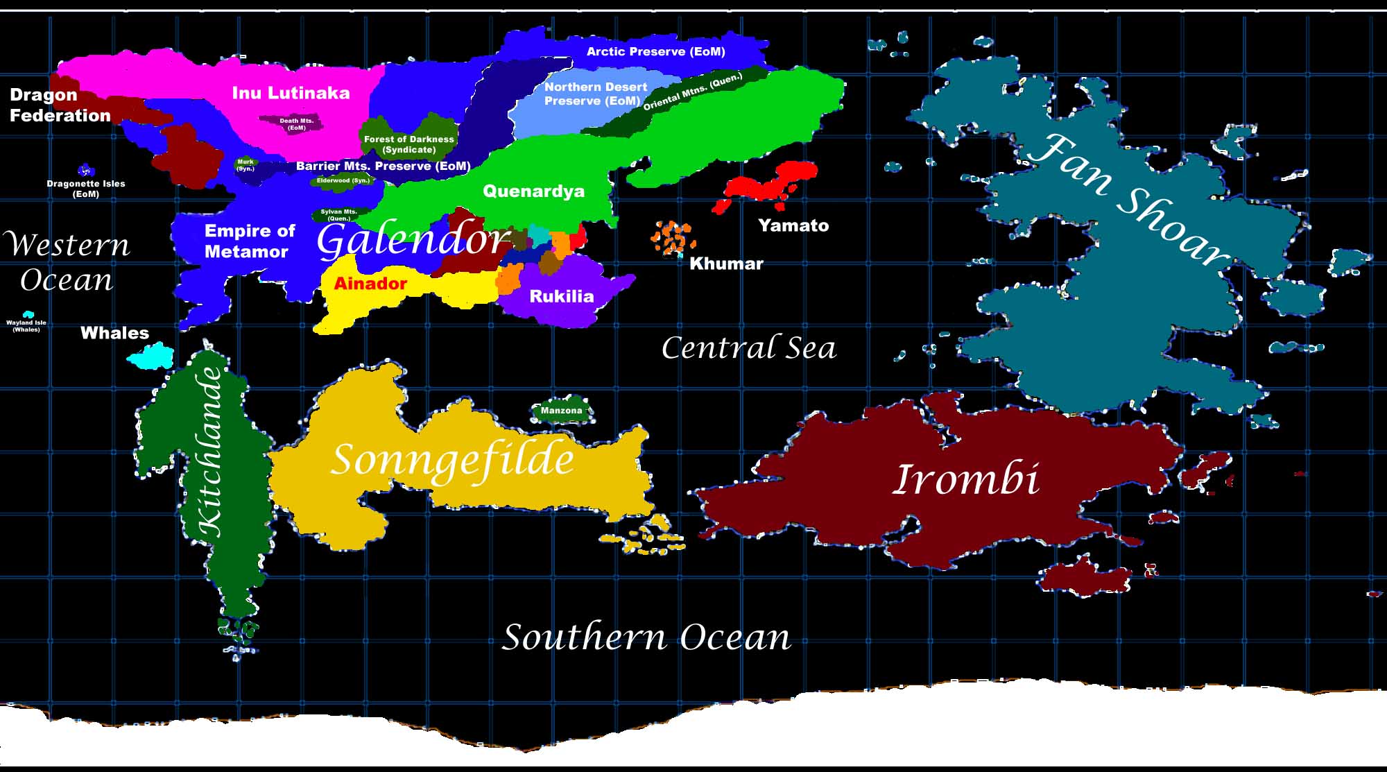
Cartesian Projection of MK2K-Earth
(click to enlarge)
There are five major continents, oriented around the Central Sea. There is also an Antarctic continent, which is actually smaller than our Earth's Antarctica (though it doesn't look like it on this projection).
At this time, political boundaries are only shown for the continent of Galendor, which drives most of the major world events. More information will be forthcoming as this page is updated.
Note that, since it is mapping a spherical planet onto a rectangular surface, the cartesian projection (called an Equidistant Cylindrical Projection) above distorts the size of regions near the poles. Refer to the following global projections to get a better sense of the actual size of the landmasses.
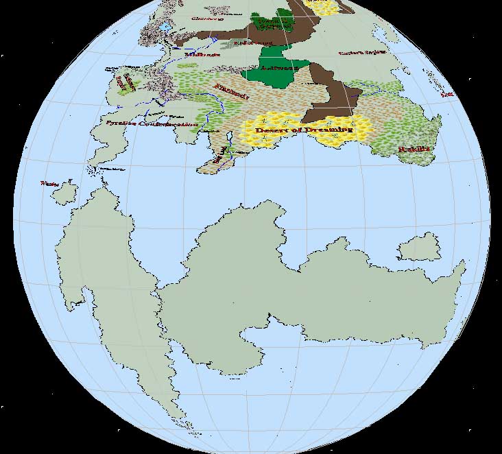
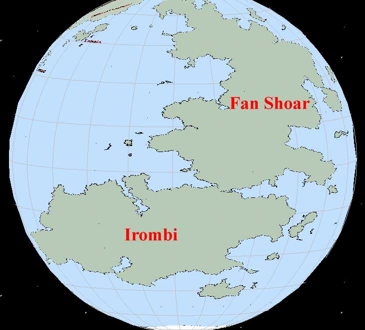
Global Projections along Equator -- Western & Eastern Hemispheres
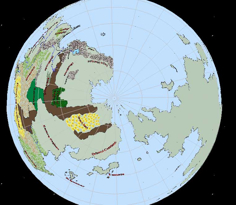
Polar Projection -- Arctic
To give another measure of the relative sizes of landmasses in this world, here's a copy of the cartesian map with a map of our Earth superimposed atop it (using the same type of projection):
MK/RL Comparison Map
Horizontal distances are the same when measured at the same parallel, or on the opposite parallel across the equator. Vertical distances between latitude lines are all equal (when using the gridlines on the MK map -- the RL map uses a smaller grid with the same projection).
A few items of note: